- Engineering Consulting
- Hydrology
- Smart Scan
- Surveying
- Scanning
- Drone
- Mobile Mapping & surveying
- GIS & Data Management
- Data Processing, Deliverables & Reporting
- Hydrographic & Marine Surveys (when applicable)
- 3D Laser Scanning & Smart Surveying
- Aerial & Drone-based Surveys
- Corridor & Transportation Surveys
- Utility & Infrastructure Surveys
- Engineering & Construction Surveys
- Topographic & Cadastral Surveys
- Control & Geodetic Networks
- GIS
- Geophysics
- Programing
- Building Information Modeling
- Environmental
- AI & Smart Cites

Department
Interactive Maps
Interactive Maps
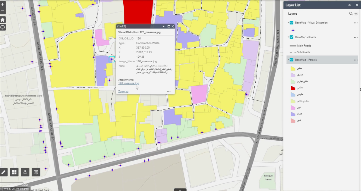
We design and develop dynamic, user-friendly maps that allow stakeholders to explore, analyze, and interact with geographic data in real time. These maps provide clear visualizations, customizable layers, and intuitive tools that enhance decision-making, improve spatial understanding, and make data accessible to all users.