- Engineering Consulting
- Hydrology
- Smart Scan
- Surveying
- Scanning
- Drone
- Mobile Mapping & surveying
- GIS & Data Management
- Data Processing, Deliverables & Reporting
- Hydrographic & Marine Surveys (when applicable)
- 3D Laser Scanning & Smart Surveying
- Aerial & Drone-based Surveys
- Corridor & Transportation Surveys
- Utility & Infrastructure Surveys
- Engineering & Construction Surveys
- Topographic & Cadastral Surveys
- Control & Geodetic Networks
- GIS
- Geophysics
- Programing
- Building Information Modeling
- Environmental
- AI & Smart Cites

Department
GEO-BIM
Through a unique combination of engineering, construction and design disciplines and expertise.
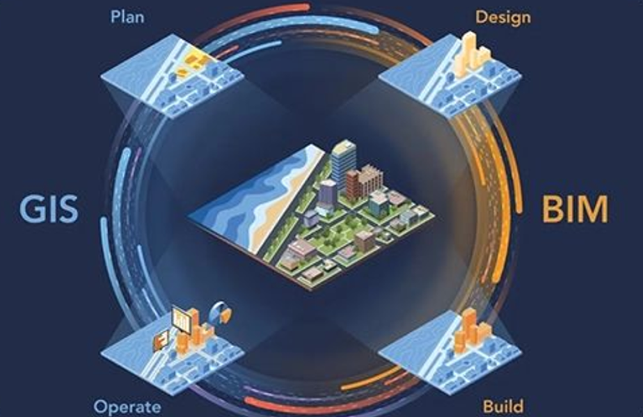
GEO-BIM
Geo BIM technology helps engineers, construction teams and project owners design, build and maintain smarter and more sustainable infrastructure, cities and communities for the future. One of the key benefits of GIS and BIM integration is improved collaboration and communication between different stakeholders in the design and construction process. By having a common digital platform that everyone can access, giving you a holistic and up-to-date view.