- Engineering Consulting
- Hydrology
- Smart Scan
- Surveying
- Scanning
- Drone
- Mobile Mapping & surveying
- GIS & Data Management
- Data Processing, Deliverables & Reporting
- Hydrographic & Marine Surveys (when applicable)
- 3D Laser Scanning & Smart Surveying
- Aerial & Drone-based Surveys
- Corridor & Transportation Surveys
- Utility & Infrastructure Surveys
- Engineering & Construction Surveys
- Topographic & Cadastral Surveys
- Control & Geodetic Networks
- GIS
- Geophysics
- Programing
- Building Information Modeling
- Environmental
- AI & Smart Cites

Department
Digital Twins
Through a unique combination of engineering, construction and design disciplines and expertise.
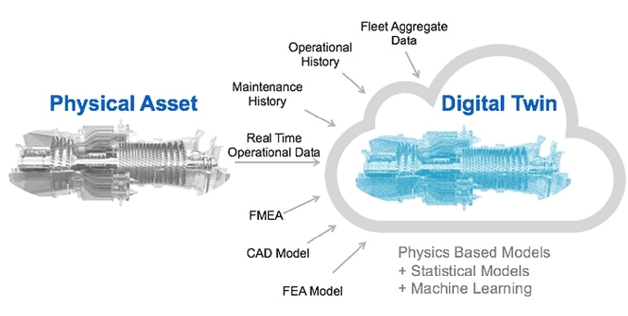
Digital Twins
Our Digital Twin solutions create dynamic virtual replicas of physical assets, infrastructure, and cities. By integrating real-time data with 3D models, we enable smarter monitoring, predictive analytics, and optimized decision-making for sustainable urban development and efficient operations.