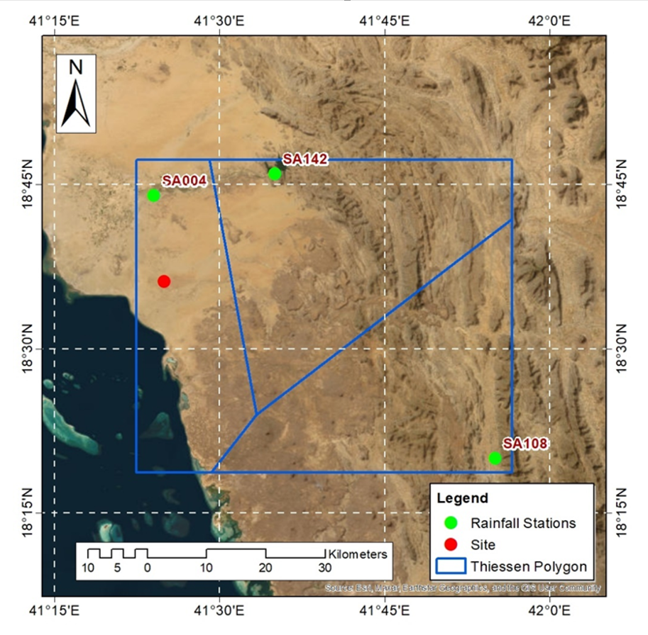
AJC specializes in simulating the movement of water in rivers, lakes, and other water bodies. Our surface water modeling services help manage water resources, design hydraulic structures, and reduce flood risks. With detailed simulations of flow patterns and water levels, we ensure sustainable water management for both natural and urban settings.
- Engineering Consulting
- Hydrology
- GIS
- Smart Scan
- Geophysics
- Electromagnetic Terrain Conductivity (TEM)
- Magnetic survey
- Borehole Geophysical and Video Logging
- Microgravity Surveys
- Seismic Tomography
- Seismic Refraction, using delay-time & tomography data analysis
- Cross hole Seismic Testing
- Very Low Frequency (VLF) Profiling
- Electrical Resistivity Tomography (ERT), Soundings, and Profiling
- Programing
- Building Information Modeling
- Environmental
- AI & Smart Cites

Department
Surface Water Modeling

